Below are the descriptions of GITT business areas.
System Integration
Develops GIS-applied programs, which enable more effective and systematic management of spatial information and data in an era flooded with information and knowledge
GIS Measurement
Surveys national control points and public control points (Static-GPS)
GIS DB Structure
A complex geographic information system designed to support the search and analysis of information collected through satellites, including standard maps, topographic information, and underground facilities, etc., through the computer.
Multi-dimensional Spatial Video
Mobilizes a talented workforce with extensive experience in the field to treat, analyze, and process various visual data and produce thematic visual maps
LiDAR Filtering
Acquires global images of the target objects with details with minimum interference with the surroundings.
GITT Inc. is the only Korean company specializing in spatial information innovation determined to create values for the future industry through standardization, fusion, and integration of spatial information, both domestically and abroad.
Below are the varied solutions GITT offers
-
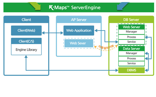
The first standardized solution in Korea!!
- Cross-browsing based on web standard
- Various WAS
- All operating systems compatible with JVM
- Domestic and international DBMS
- Domestic and international GIS Engine
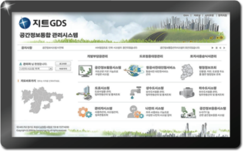
-
The only multiple spatial information related services provider in Korea!!
- Compliant with standard regulations and specifications
- Multiple integrated services
- Standard system development and related support
- Mass-storage and high-performance processing capacity
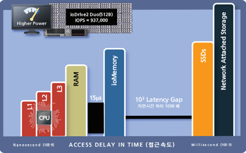
-
Storage solution to support expedient services of large storage big data and high-resolution videos
- Real-time performance monitoring and alarm in advance
- Historic performance report
- Prediction of life span
- Intuitive user web interface
- Remote access and setting
- Integrated cashing options for bare metal / virtual settings
As a partner of our customers, GITT Inc.works to ensure the practical application of spatial information in different fields with honesty diligence and.
Our Clients

