System Integration
- Business Areas
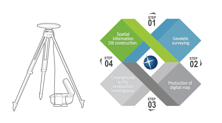
- System Integration
We develop GIS-applied programs, which enable more effective and systematic management of spatial information and data, in today’s era flooded with information and knowledge. Currently, we are concentrating on the development of a technology-intensive system applied with cutting-edge IT technology, in addition to the GIS system that had been built having taken the ubiquitous environment into account.
- LBS based mobile application system (field work support system)
- City based facility management system (roads, sewers, waterworks)
- Urban planning information service (UPIS)
- Underground water management system
- New address system management / Navigation system
- Coastal waters quality management system
- Satellite image information system
- Urban park management system
- River management system
- Artificial reef maintenance system
- Regional fishing port management system