Multi-dimensional Spatial Video
- Business Areas
- Multi-dimensional Spatial Video
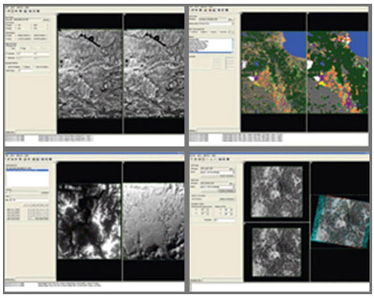
We mobilize a talented workforce with extensive experience in the field to treat, analyze, and process various visual data, including high resolution optical satellite images, ultra-high resolution aviation digital photographs/videos, radar videos, and hyperspectral images. Using the acquired data, we produce thematic visual maps, 3D simulations, numerical altitude data, imagery interpretation, and multi-dimensional spatial information to provide systematic outcomes in your business field.
Image processing work
- Mosaic
- Geometric Correction
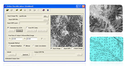
- Orthorectification
- Classifiction
- Production of 3D simulation
- DEM
- Image Analysis
- Map Composer